Filyos Limanı Seyir Emniyeti Uygulamaları
Özet
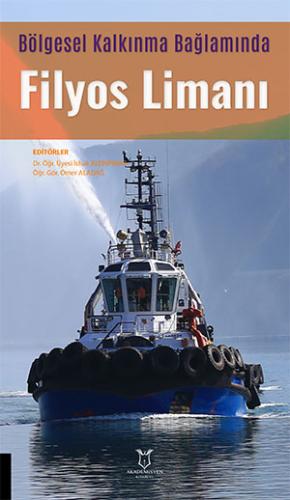
Filyos Limanı, Batı Karadeniz Bölgesi'nin en yüksek yük elleçleme kapasitesine sahip olması planlanan ve tamamlandığında Türkiye'nin en büyük üçüncü limanı konumuna gelmesi beklenen stratejik bir tesistir. Ana dalgakıranı 2450 metre, tali dalgakıranı 1370 metre ve rıhtım uzunluğu 3000 metre olan liman, tankerler hariç aynı anda 13 gemiyi barındırabilecek kapasiteye ve Sakarya Gaz Sahası'ndaki lojistik operasyonları karşılama işlevine sahiptir. Limanda emniyetli seyir için VHF kanal 10-12-16 üzerinden iletişim kurulmakta, su derinliği 20 metre ve emniyetli genişliği 200 metre olan 1 numaralı bölgeden kılavuz kaptan eşliğinde giriş yapılmaktadır. Bölgede baskın rüzgâr yönü kuzeydoğu ve kuzeybatı olup ortalama hızı 6.8 m/s seviyesindedir. Deniz trafiğinde ticari gemilerin yanı sıra Filyos Balıkçı Barınağı'nı kullanan balıkçı tekneleri ve gezi araçları da yer aldığından trafik ayrım hatlarının ve kısıtlı alanların belirlenmesi büyük önem taşımaktadır. Türkiye karasularına uygun olarak IALA-A şamandıra sisteminin kullanıldığı limanda, pilotaj, palamar ve 24 saat kesintisiz römorkör hizmeti planlanmış; farklı rıhtım bölgelerinde 100 ve 150 ton kapasiteli babalar yer almıştır. Ayrıca, bölgedeki tehlikeli yük taşıyan gemiler için TPAO tarafından MARPOL ve IMDG kurallarına uygun Tehlikeli Madde Rehberi hazırlanmış, ayrı bir demir alanı tahsisi ve Filyos Çayı'ndan gelen alüvyon nedeniyle düzenli iskandil kontrolleri yapılması önerilmiştir.
Filyos Port is a strategic facility planned to have the highest cargo handling capacity in the Western Black Sea Region and expected to become the third largest port in Turkey upon completion. Featuring a main breakwater of 2,450 meters, a secondary breakwater of 1,370 meters, and a quay length of 3,000 meters, the port can accommodate 13 vessels simultaneously (excluding tankers) and serves operational logistics for the Sakarya Gas Field. For navigational safety, communication is established via VHF channels 10-12-16, with entry conducted under pilot guidance through Area 1, which has a water depth of 20 meters and a safe channel width of 200 meters. The prevailing wind directions in the region are northeast and northwest, with an average speed of 6.8 m/s. Because maritime traffic includes fishing boats and recreational vessels using the Filyos Fishing Shelter alongside commercial ships, establishing traffic separation schemes and restricted areas is critical. Utilizing the IALA-A buoyage system in line with Turkish territorial waters, the port plans 24/7 uninterrupted pilotage, mooring, and tugboat services, with bollard capacities of 100 and 150 tons positioned across different quay sections. Furthermore, TPAO has prepared a Dangerous Goods Guide compliant with MARPOL and IMDG regulations for vessels carrying dangerous cargo, while recommending a dedicated anchorage area and regular bathymetric sounding checks due to sediment carried by the Filyos River.
Referanslar
Aydoğan, B., Ayat, B., Yüksel, Y., 2013, Black Sea wave energy atlas from 13 years hindcasted wave data, Renewable energy, 57, 436-447.
Büber, M., Töz, A. C., 2019, LİMAN SAHASINDA MEYDANA GELEN GEMİ KAZALARININ KONUMSAL ANALİZİ: EGE BÖLGESİ İÇİN BİR UYGULAMA, Dokuz Eylül Üniversitesi Denizcilik Fakültesi Dergisi, 11, 1-16.
Chauvin, C., Lardjane, S., Morel, G., Clostermann, J.-P., Langard, B., 2013, Human and organisational factors in maritime accidents: Analysis of collisions at sea using the HFACS, Accident Analysis & Prevention, 59, 26-37.
Çoban, B., Balkıs, N., Aksu, A., 2009, Heavy metal levels in sea water and sediments of Zonguldak, Turkey, Journal of the Black Sea/Mediterranean Environment, 15(1).
Darbra, R. M., Crawford, J., Haley, C., Morrison, R., 2007, Safety culture and hazard risk perception of Australian and New Zealand maritime pilots, Marine policy, 31(6), 736-745.
Denizde Çatışmayı Önleme Tüzüğü. 2017, Denizde Çatışmayı Önleme Tüzüğü (COLREGs), Seyir Hidrografi ve Oşinografi Dairesi Başkanlığı Yayınları, ISBN, 978, 975-499.
Dimailig, O. S., Jeong, J.-Y., Kim, C.-S., 2011, Marine Transportation in the Philippines: The Maritme Accidents and their Causes, Journal of Navigation and Port Research, 35(4), 289-297.
Driscoll, T. R., Harrison, J. A., Steenkamp, M., 2004, Review of the role of alcohol in drowning associated with recreational aquatic activity, Injury Prevention, 10(2), 107-113.
Goerlandt, F., Goite, H., Banda, O. A. V., Höglund, A., Ahonen-Rainio, P., Lensu, M., 2017, Ananalysis of winter time navigational accidents in the Northern Baltic Sea, Safety science, 92, 66-84.
Hsu, W.-K. K., Huang, S.-H. S., 2014, Evaluating the service requirements of Taiwanese international port distribution centres using IPA model based on fuzzy AHP, International Journal of Shipping and Transport Logistics, 6(6), 632-651.
Hsu, W., 2010, The navigation safety of ships in ports, Transportation Planning Journal, 39(3), 301322.
IALA, 2017, R1001 THE IALA MARITIME BUOYAGE SYSTEM (1.1 ed.), International Association of Marine Aids to Navigation and Lighthouse Authorities Association Internationale de Signalisation Maritime, Saint Germain en Laye. https://www.iala-aism.org/
Islek, F., Yuksel, Y., 2021, Inter-comparison of long-term wave power potential in the Black Sea based on the SWAN wave model forced with two different wind fields, Dynamics of Atmospheres and Oceans, 93, 101192.
Kara, G., 2016, ANALYSIS OF METEOROLOGICAL FACTORS AFFECTING ON MARITIME TRANSPORT SYSTEMS, PROCEEDINGS BOOK, 693.
Karaca, I., Saraçoğlu, R., Söner, Ö., 2020, Meteorological Risk Assessment for Ships with Fuzzy Logic Designer.
Kılıç, A., Sanal, H. T., 2015, Çanakkale Boğazı’nda karaya oturmayla sonuçlanan gemi kazaları, Balıkesir Üniversitesi Fen Bilimleri Enstitüsü Dergisi, 17(2), 38-50.
Kodak, G., Gökhan, K., Yıldız, M., Salcı, A., 2022, İstanbul Boğazı’ndaki Deniz Kazalarının Seyir Emniyeti Perspektifinde İncelenmesi: İSTANBULMAKS Gemi Tipi Önerisi, Aquatic Research, 5(1), 63-88.
Liu, C.-P., Liang, G.-S., Su, Y., Chu, C.-W., 2006, Navigation safety analysis in Taiwanese ports, The Journal of Navigation, 59(2), 201-211.
Liu, C., Liang, G., Su, Y., Chu, C., 2005, Analysis of navigation safety in Taiwanese’, Maritime Quarterly, 14(1), 1-20.
Liu, Z., Wu, Z., Zheng, Z., 2019, A cooperative game approach for assessing the collision risk in multi-vessel encountering, Ocean Engineering, 187, 106175.
Mengert, P., Susman, E., DiSario, R., 1993, A study of the relationship between the risk of fatality and blood alcohol concentration of recreational boat operators, Journal of Safety Research, 24(2), 123-123.
Molberg, P. J., Hopkins, R. S., Paulson, J., Gunn, R. A., 1993, Fatal incident risk factors in recreational boating in Ohio, Public health reports, 108(3), 340.
Nedelcu, L.-I., Rusu, E., 2022, An analysis of the wind parameters in the western side of the Black Sea, Inventions, 7(1), 21.
Özdemir, Ü., Güneroğlu, A., 2015, Strategic approach model for investigating the cause of maritime accidents, PROMET-Traffic&Transportation, 27(2), 113-123.
Pense, C., 2018, Deniz kazalarında insan faktörü ve bir çözüm olarak e-seyir, Akıllı Ulaşım Sistemleri ve Uygulamaları Dergisi, 1(2), 72-86.
Resmi Gazete, 2009, Seyir Yardımcıları Yönetmeliği. https://www.mevzuat.gov.tr/anasayfa/Mevzu atFihristDetayIframe?MevzuatTur=7&MevzuatNo=13068&MevzuatTertip=5, [Ziyaret tarihi:
Rusu, E., Onea, F., Toderascu, R., 2011, The Black Sea: Dynamics, Ecology and Conservation, Ch. Dynamics of the environmental matrix in the Black Sea as reflected by recent measurements and simulations with numerical models.
Rusu, L., Bernardino, M., Guedes Soares, C., 2014, Wind and wave modelling in the Black Sea, Journal of Operational Oceanography, 7(1), 5-20.
Rusu, L., Ganea, D., Mereuta, E., 2018, A joint evaluation of wave and wind energy resources in the Black Sea based on 20-year hindcast information, Energy Exploration & Exploitation, 36(2), 335-351.
Szlapczynski, R., 2015, Evolutionary planning of safe ship tracks in restricted visibility, The Journal of Navigation, 68(1), 39-51.
Tian, W., Ma, Q., Zhang, J., Meng, B., Gan, Z., Wan, H., He, Y., 2020, Ship collision risk assessment model for qinzhou port based on event sequence diagram, Brodogradnja: Teorija i praksa brodogradnje i pomorske tehnike, 71(2), 1-14.
TPAO, 2020, TÜRKİYE’NİN KARADENİZ’DEKİ İLK ULTRA – DERİN DENİZ KEŞFİ. Retrieved 25.08.2020 from https://www.tpao.gov.tr/file/2010/basin-bulteni-tuna-1-kesif-17-10-2020-3815f8b0eef56dce.pdf, [Ziyaret tarihi: 25.08.2020].
TPAO, 2021, Filyos Türkiye Petrolleri Limanı Tehlikeli Madde Rehberi. Retrieved 20.07.2022 from https://tp-otc.com/wp-content/uploads/2022/01/TP-OTC-TEHLIKELI-MADDE-REHBERI-V10_PDF.pdf, [Ziyaret tarihi: 20.07.2022].
TPAO, 2022, TPAO, Kıyı Lojistki Merkez Yönetimi. Retrieved 27.06.2022 from https://tp-otc.com/kiyi-lojistik-merkezi-yonetimi/, [Ziyaret tarihi: 27.06.2022].
Turgut, M., Şahin, Z., Şahin, A. Y., 2020, Zonguldak’in lojistik potansiyeli ve mevcut durum analizi, IBAD Sosyal Bilimler Dergisi, 269-289.
Twrdy, E., Petrovič, M., Batista, M., 2013, Limitation and restrictions on the admission of postpanamax container ships in the port of Koper, Brodogradnja: Teorija i praksa brodogradnje i pomorske tehnike, 64(4), 456-471.
UAB, 2021, UAB, Karadeniz’in Yeni Lojistik Üssü Filyos Limanı, Hizmete Açıldı. Retrieved 26.06.2022 from https://www.uab.gov.tr/haberler/karadeniz-in-yeni-lojistik-ussu-filyos-limani-hizmete-acildi, [Ziyaret tarihi: 26.06.2022].